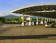
Trinidad Piarco International Airport (POS)
Driving Directions / Travel by Car
(Trinidad, West Indies)
Conveniently positioned close to Port of Spain, the island's capital city, Piarco International Airport (POS) lies on the northern side of Trinidad, to the west of Sangre Grande and in the town of Piarco. Drivers bound for the airport can follow signs to Port of Spain, from where the terminal at Piarco Airport is well signposted.
Alternatively visitors can navigate their way through the island's charming towns and follow the numerous signs for the airport. Further afield you will find San Fernando and Princes Town directly south, while the Royal Borough of Arima is situated to the east and is one of the island's largest and most appealing towns.
Directions to Piarco International Airport (POS) from the north of Trinidad:
- From Maracas, head south for St. Joseph
- From St. Joseph, continue south, following signs for the terminal
Directions to Piarco International Airport (POS) from the south of Trinidad:
- From Moruga, head north for Prince's Town
- From Prince's Town, continue north to Tabaquite
- From Tabaquite, continue north to Chaguanas and then follow the signs for the airport
Directions to Piarco International Airport (POS) from the east of Trinidad:
- From Pierreville, head west towards Rio Claro
- From Rio Claro, head north-west to Tabaquite
- From Tabaquite, continue north to Chaguanas, then follow the airport signposts
Directions to Piarco International Airport (POS) from the west of Trinidad:
- From Couva, head north-east to Chaguanas
- From Chaguanas, continue north, following the signs
Roads from Port of Spain are renowned for becoming congested during peak times and similarly, other roads on the island of Trinidad can become busy.
